
Rangitoto Island: the free volcano hike everyone visiting Auckland should do
Updated November 13, 2026
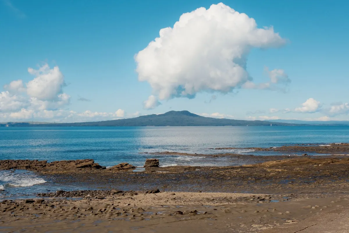
Every photo taken from Auckland's waterfront has the same cone sitting on the horizon: Rangitoto, dormant for over 600 years, just 25 minutes away by ferry. What those photos don't tell you is that climbing it costs nothing beyond the boat ticket — 7km round trip, done comfortably in a morning. We built this from the official DOC (Department of Conservation) track page cross-checked against people who've actually walked it, skipping the padding.
Getting there and timing it right
Ferries leave Queens Wharf in downtown Auckland and take about 25 minutes to Rangitoto Wharf (a few sailings detour via Devonport first, adding minutes). Block out half a day — 4 to 5 hours — for the round trip plus the hike itself: the wharf posts the last ferry time of the day, and missing it leaves you stranded on the island, literally.
What the trail actually demands
DOC lists the Summit Track at 7km return, about 2 hours of climbing to the 259m summit, through lava fields and the world's largest pōhutukawa forest. The surface is uneven — loose volcanic rock in stretches — but there's no technical climbing, so basic fitness gets you there. The catch: almost no shade on the main stretch, which turns a hot day into a harder day than the distance alone suggests.
The lava caves are worth the 500m detour
About 45 minutes up from the wharf (15 minutes below the summit), a signposted side trail runs 500m into lava caves formed by the volcano's own eruption. Bring a torch — the inside is properly dark, not dim.
Packing list
- Closed, sturdy shoes — the lava terrain shreds sandals and thin sneakers.
- Your own water and food: nothing is sold on the island, and there's no drinking water.
- Sunscreen, given the lack of shade on most of the route.
- A torch if you're doing the caves.
- A bag for your own rubbish — there are no bins on the island.
Worth it on a tight budget?
Yes, easily one of the cheapest, most rewarding hikes near any capital city: the only mandatory cost is the ferry — NZ$55 return for an adult, NZ$25 for a child, NZ$119 for a family package, per the official Fullers360 fare page — and the trail itself is 100% free, with a summit view well out of proportion to the effort.
What people who've actually hiked it recommend (and most guides skip)
The island's only toilets sit near the lighthouse and near the walkway to Motutapu — both a solid walk from the summit and the main wharf, so use one before starting the climb. Pack more water than seems necessary: travelers consistently report feeling thirstier here than expected, likely from the heat the dark volcanic rock holds onto. A compact rain jacket helps too, since showers can roll in fast even on a day that started clear. With extra time, you can extend the loop to include the coastal track and the causeway over to neighboring Motutapu Island, bringing the total to around 13km — well beyond the 7km Summit Track alone, but with beaches and bays most day-trippers never see. One detail that's easy to miss: because the island has no introduced predators, pausing for a moment during the climb often rewards you with native birds you won't find anywhere on the mainland.
Several visitors who've done the hike recently also point to the late-morning 9:30am ferry out and the 2:30pm return as a comfortable window — early enough to beat the worst midday heat on the exposed summit stretch, and early enough back that missing the sailing isn't a risk.Keep planning
Check out the full itinerary: New Zealand North Island Itinerary: Auckland, Rotorua, Wellington, Hobbiton, Bay of Islands and Tongariro on a Controlled Budget
See also: Common scams against tourists: how to recognize and protect yourself anywhere